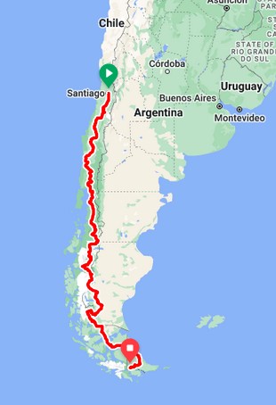
The goal is to go to the bottom most part of the world that a bicycle can reach, while enjoying a few extra fun tid-bits along the way. (Okay, I suppose a bicycle can also go to Antarctica, but we’re thinking of average people like us.) So here’s the skeleton of that plan.
We start in Santiago, Chile and end in Ushuaia, Argentina. The ride, from start to finish, is divided into 3 segments or legs. Each leg lasts roughly a month, give or take a number of days, as the “wing-it” nature of bike traveling always holds true. Also, each leg naturally covers a distinct region, easily separable from the others.
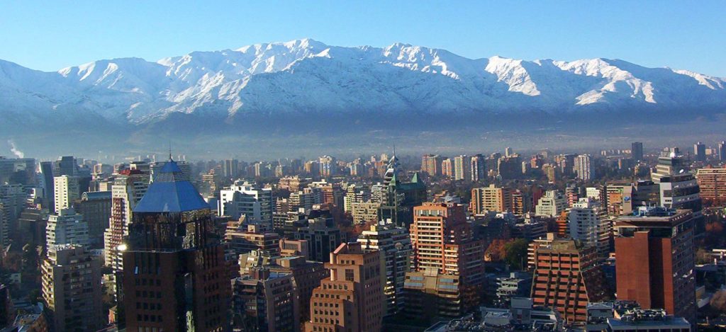
LEG 1 — CENTRAL CHILE. Most of the population lives in the central part of Chile. The cultural life that defines Chile happens here. We land in Santiago, the capital of Chile, situated in the midst of the region, and spend a week in this city to get acclimated, prepare for the bicycle journey, and of course see the city and surroundings.
Then we start heading south. We’ll take approximately a month to travel through the rich cultural part of Chile. When we reach the town of Puerto Montt, we would have reached the end of Leg 1.
LEG 2 — CARRETERA AUSTRAL
This southern section of Chile is considered the less developed part of Chile, separate culturally from the “more refined” Central Chile. In Chile’s expansion, this region would be comparable to the USA’s Wild West. In the 1970’s, Chile’s then-dictator Pinochet commissioned a road to tie this southern region to Central Chile (so that Argentina won’t somehow take over that undefended area). And so the Carretera Austral, or Southern Road, was created. Although the actual path has been dug, today only about half of it has been paved, with spotty construction still ongoing.
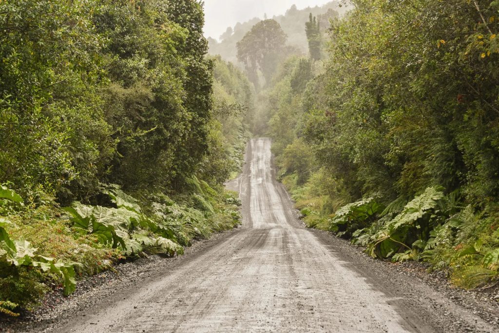
An unfinished part of the Carretera Austral
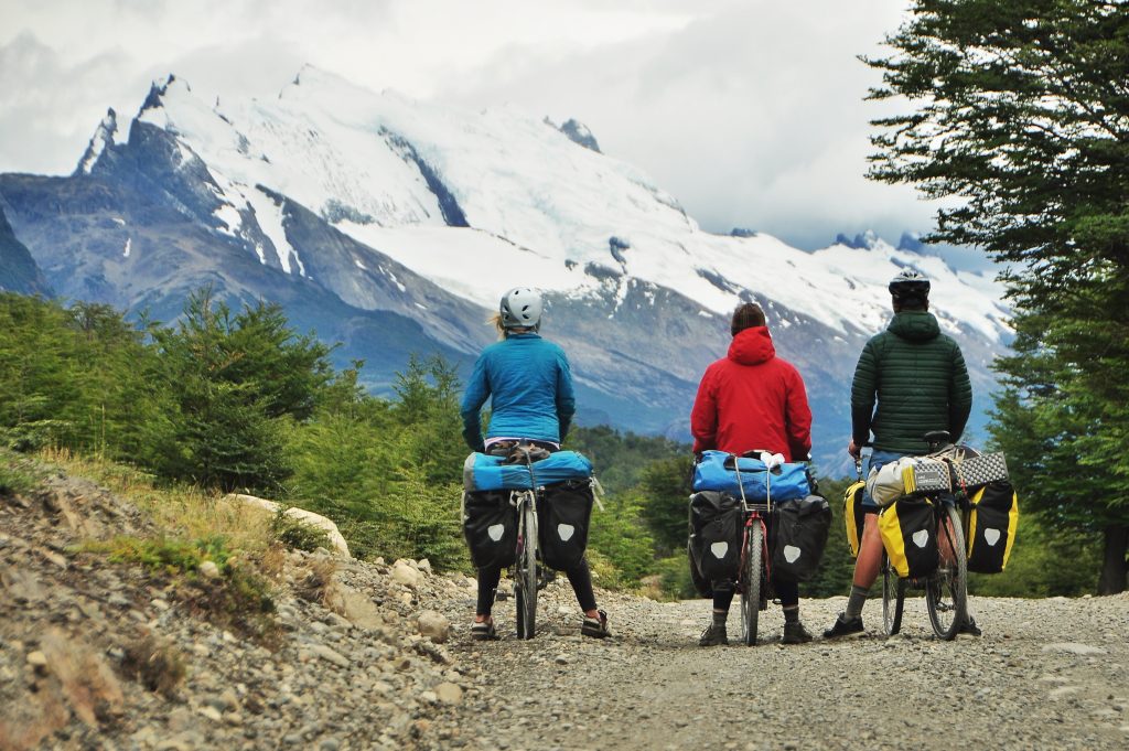
We begin at the north end of the Carretera Austral in Puerto Montt and will take roughly one month to reach the other end of the road, an outpost called Villa O’Higgins. Although Chile’s claimed land extends much further south, the road ends here because the lands further south are mountainous and divided by many islands, making road construction difficult, if not impossible. So we will have to cross over to Argentina for our third leg.
LEG 3 — TIERRA DEL FUEGO
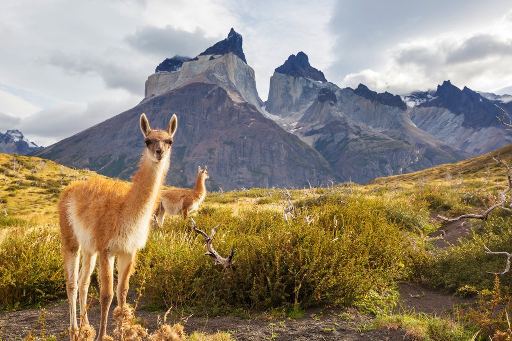
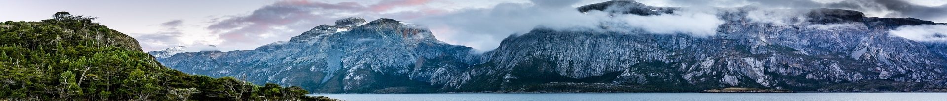
Torres del Paine National Park, Patagonia
Leaving Villa O’Higgins, we cross the border into Argentina and ride through miles of the undeveloped Patagonia. Still, we will have to crisscross the border between Chile and Argentina several times as we head south– because of the terrain and because the border weaves back and forth. At some point, we cross a strait to reach a huge island called Tierra del Fuego (Land of Fire). After the month long trek, we reach the town of Ushuaia, overlooking the Beagle Channel, part of the waters where the Atlantic meets the Pacific at the bottom of South America. Ushuaia is the most southern town in the world, latitude-wise, and thus called “El Fin Del Mundo” — the “End of the World.” Our journey ends here.
This looks to be quite an adventure. We are so looking forward to it.
Very well done Thuan! It’s fast approaching. Let’s do this!
I’m ready. But my plane ticket says “Wait just a bit more.” 🙂 ~Thuan
[…] But bicycles and backpackers do head further south until the Carretera finally ends in a town called Villa O’ Higgins. We are planning on taking a desolate 7-day trek to get there. So today we are shopping for 7 days of food to carry with us. I’ll fill you in on what we’ll do when we get to the end of the Carretera Austral. (An outline is given here.) […]